
How GIS is starting to underpin successful BIM strategies
/
While BIM (Building Information Modelling) has been around for a decade or more, legislation has recently been introduced in the UK which compels organisations wishing to tender for government construction contracts to use a BIM process to record, store and exchange digital packages in which spatial context is significant. Essentially this is making planners, designers, architects and engineers consign paper to bin and commit to a digital future. So what role does GIS have to play in supporting compliance and robust BIM strategies?
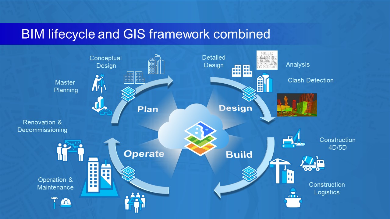
Let’s start with the four broad phases of the BIM lifecycle: Plan, Design, Build and Operate. Esri’s ArcGIS platform is deployed by a range of organisations that operate in one or more phases, from Foster & Partners in the Design phase to Skanska in Build Esri UK is also supporting customers such as Sellafield Ltd with who are also using GIS to safely deliver decommissioning, reprocessing and nuclear waste management activities on behalf of the Nuclear Decommissioning Authority.
No matter whether redundant buildings are being decommissioned, infrastructure projects such as Crossrail are being developed or large-scale developments such as King’s Cross in London are underway, everything sits on the earth. Understanding a location’s geographic context is vitally important and hence maps have been used across all phases of the BIM lifecycle for many years. But GIS offers far more than digital mapping.
Architects and Urban Planners use GIS as one of their key business systems. By adding a co-ordinate and geographical context to their drawings, it not only enriches their data but also drives efficiency when these drawings and designs can be easily shared with builders and contractors, with just one click. With a rise in the use of Lidar data and drone-captured imagery, ArcGIS can create orthomosaics, 3D meshes and more in minutes rather than days, bringing new visualisations into play.
GIS continues to play a pivotal role in the Operate phase for organisations such as Highways England. Information can be shared with both internal and external stakeholders; multiple projects can be scheduled and critical business decisions analysed with ArcGIS. The ArcGIS platform supports the digital handover across all phases and while one of the biggest challenges remains data standards and naming conventions, we are working with organisations such as GeoEnable to unlock these data conundrums.
It’s fair to say that at different points through the BIM lifecycle an organisation will be more reliant in certain GIS applications than others, depending on the workflow. However GIS should continue to add context, understanding, analysis and visualisation to support these workflows and the technology is beginning to integrate with CAD and document management systems to bring together non-spatial as well as spatial content. While the ‘Holy Grail’ of an all-singing, all-dancing system is some way off, we are beginning to develop an ecosystem where these applications can work together and complement each other. Developing an effective ecosystem is key to supporting the BIM lifecycle and, more importantly, achieving BIM compliance.
Read more about how other organisations are harnessing the power of GIS to enable business change, in the latest issue of ThinkGIS