Why Identity Matters - making the most of the ArcGIS Platform
/This blog post supports an Esri UK Higher Education webinar which was held on the 30th January and the 5th February 2018. In this blog post we will look at how Identity is at the heart of the ArcGIS Platform and how it enables and empowers users.
What is Identity?
Identity is a common concept and is at the heart of the many applications. Identity:
is used in many applications
empowers users, connecting them to their data
enables users to share content and collaborate with others
saves time administering access to software
allows students to work when they want, where they want
Probably the best examples of Identity are Microsoft and Google. Looking at Microsoft, their Office 365 product offers users cloud storage and lite, web applications allowing them to connect to their apps and data anywhere. Well, assuming they have a good internet connection at least. Office 365 also enables users to share content with each other. To do this the document creator would need to know the unique user ID of the people they wish to share their content with.
The Microsoft identity model - Office 365
The ArcGIS Identity works in a very similar way to Microsoft 365. It offers users
cloud storage for their spatial data
access to Esri apps
a mechanism for sharing spatial data with other users
a mechanism for publishing and disseminating authoratitive content
Pretty much every application in the ArcGIS Platform has a login function which enables users to connect to data that they have stored in ArcGIS Online (Esri's cloud storage/GIS system). The diagram below summarises this and shows which applications explicitly require users to have an identity.
Identity in the ArcGIS Platform
ArcGIS Online and the mobile apps that hang off it such as Survey123 and Collector for ArcGIS require users to have an identity. The reason is that these applications rely on cloud storage and this is accessed through ArcGIS Online.
So, how might staff and students at your university benefit from having an Esri identity? Here are a few examples:
Identity enables Fieldwork
Students can use their ArcGIS Identity to collect data in the field, analyse the resulting data and then to share their results with a group.
Identity enables Fieldwork
In the example above:
The student uses their Identity to log into Survey123 to create and share their data collection project.
The group then uses their Identity to log into the Survey123 App on their phone to collect data.
The student that created the form uses their identity to log into ArcGIS Online to analyse their data
The student can then share the results as a web app to the group by using their Identity and association with a group in ArcGIS Online
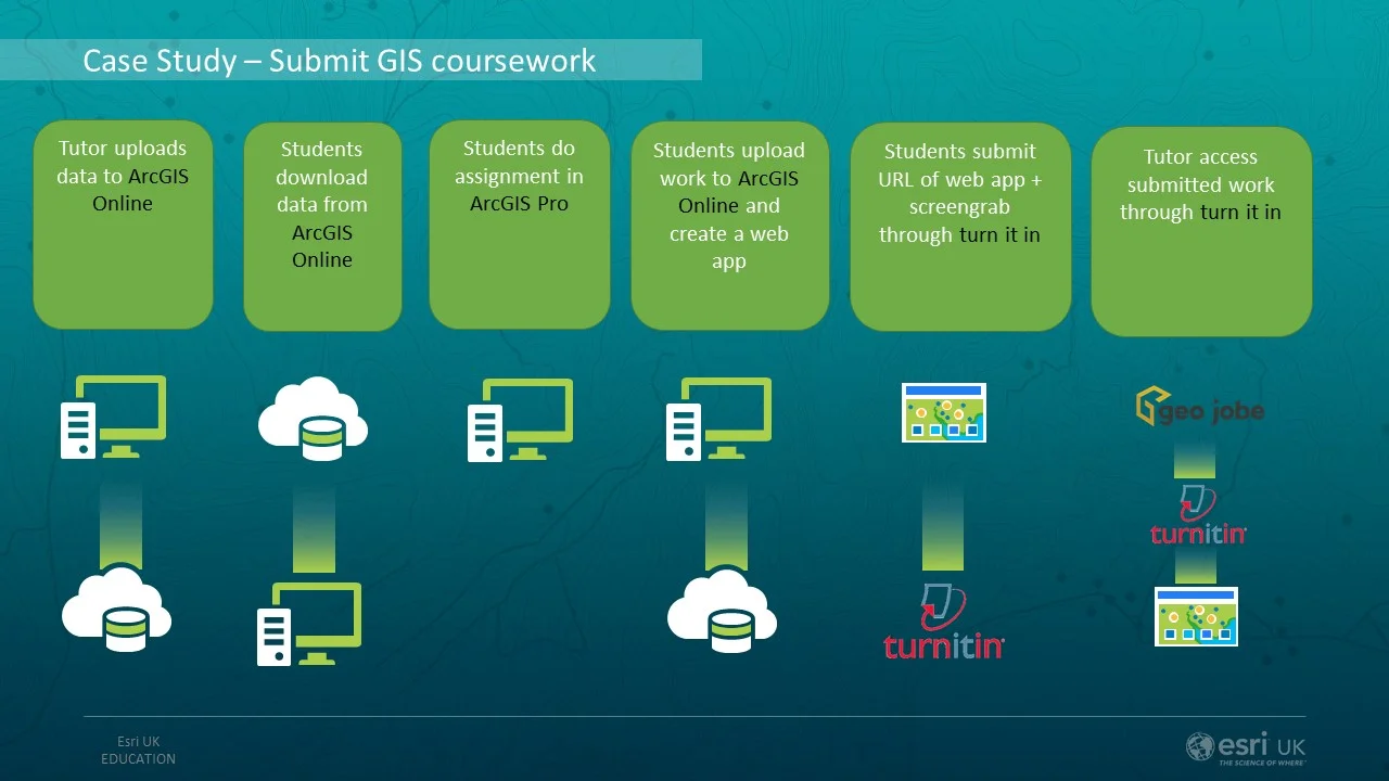
Using identity in setting and marking coursework
The 2nd example demonstrates how identity can help set and mark exercises.
The tutor uses their Identity to upload data to their ArcGIS Online account
They share this to the class group so they can use their Identity in ArcGIS Online to download the data
the students complet their analysis in ArcGIS Pro
Students use their Identity to log in to ArcGIS Online and upload their data
Student Share their web map application to the group
Students submit a screen grab and the URL to their web map through Turn It In
Tutor access the web maps through Turn It In - they will be asked to log in using their Identity to see the shared web maps
Settting an submitting course work through ArcGIS Online and TurnItIn
Identity is the key to E-Learning
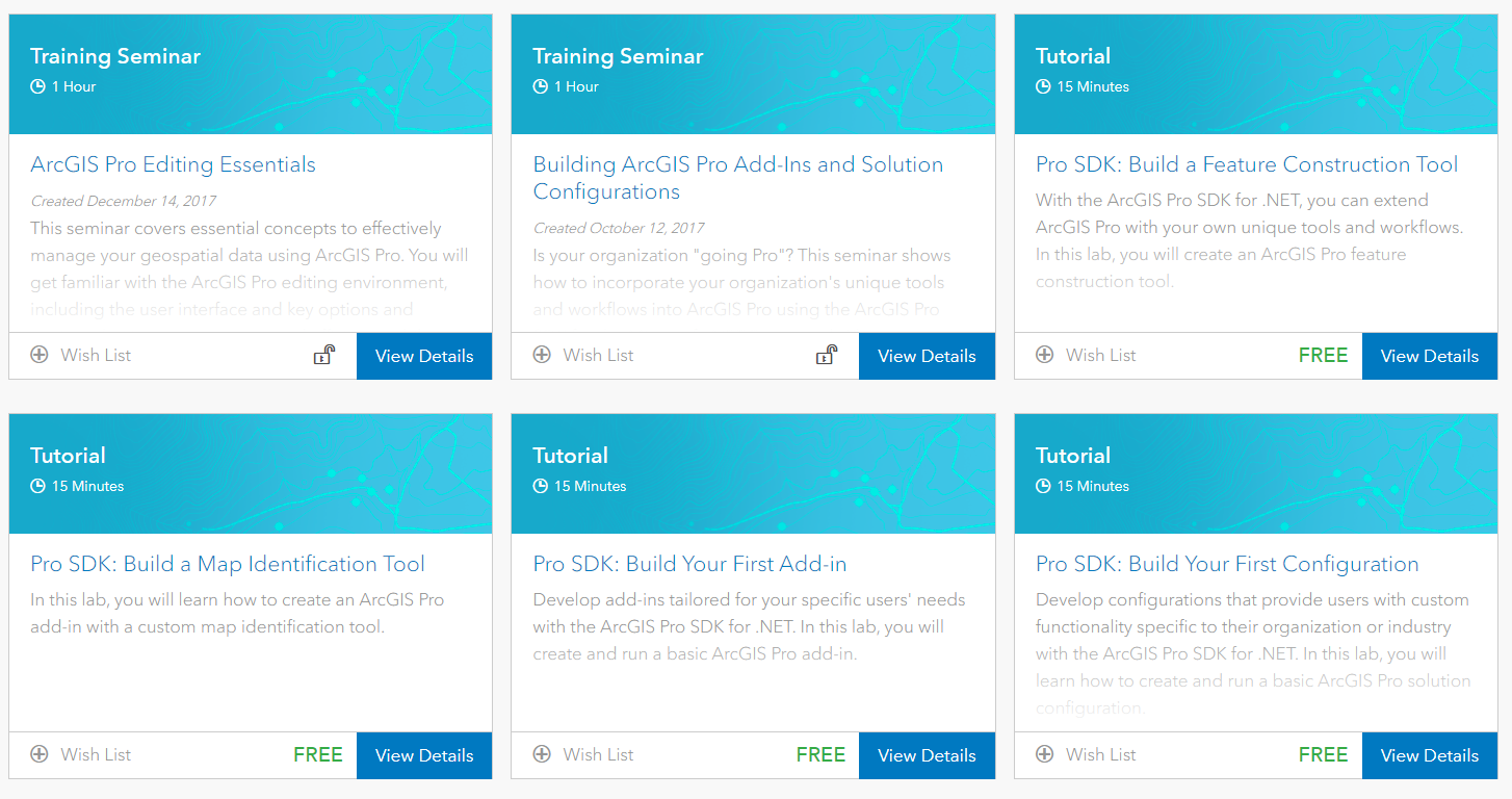
ArcGIS Identity also provides your users with access to Esri's redeveloped E-Learning site. This has hundreds of resources that allow users to self-learn. Students could top-up their knowledge and understanding or explore new functionality to support their dissertations. Some universities are even using the e-learning platform to cover the basics of GIS before more formal practicals in the lab.
Just some of the course unlocked with you Identity
Summary
Identity is right at the heart of the ArcGIS Platform. It provides users with access to applications and allows them to access their data when they want, where they want. Identity also enables users to share content and applications, fostering collaborations either within and organisation or between organisations.
The next webinar will in 2-3 weeks and will most probably focus on GeoJobe - a toolkit for managing Named Users in ArcGIS Online.
Webinar Slides


