
Forestry Commission Scotland improves its management of a diverse estate
/
Forestry Commission Scotland is using ArcGIS mobile and online tools to accelerate building surveys and provide senior managers with instant insight into the cost and criticality of repairs.
Within the mix of 700,000 hectares of forest, countryside and urban greenspace managed by the Forestry Commission Scotland, there are in excess of 750 buildings ranging from modern offices and visitor centres to ancient bothies and wood stores. The organisation can now survey these diverse structures quickly and gather more precise data about any repairs needed, using a mobile solution based on Survey123 for ArcGIS and Collector for ArcGIS.
Surveyors save many hours on each building survey as they can now capture building attributes, take photographs and record defects with simple-to-use dropdown boxes on any mobile device. The integration of Survey 123 with Collector reduces the risk of human error and data inaccuracies, by ensuring that the correct building name, forest district and reference numbers are attached to each survey report. Once a survey is completed, the mobile app automatically calculates the cost of repairs for that specific building, taking into account material costs and labour.
Estates managers at Forestry Commission Scotland then view the data from the building surveys in a clear, graphical format using Esri’s Operations Dashboard for ArcGIS. They can see, at a glance, what the total estimated cost of repairs is, across the whole estate, and easily identify any buildings where a poor state of repair might pose a safety concern or risk of litigation. The dashboard ranks buildings according to their usage, so managers can make faster decisions about when to prioritise repairs to buildings such as visitor centres and can allocate the organisation’s maintenance budget effectively.
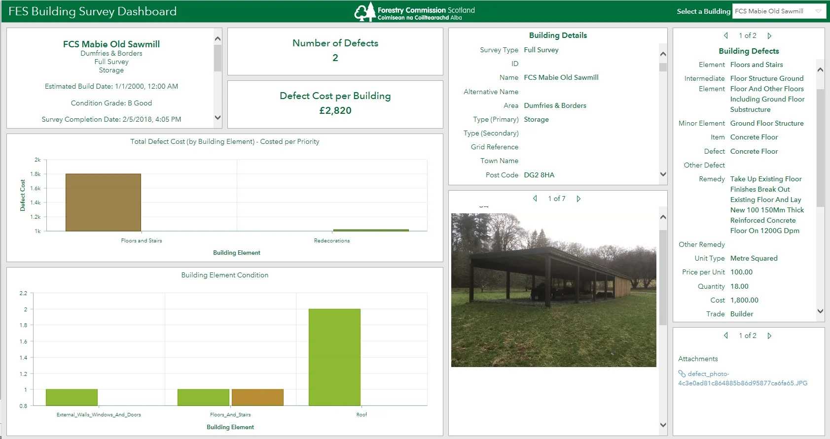
Estates managers gain a clear insight into the criticality of repairs using Esri’s Operations Dashboard for ArcGIS
“ArcGIS has transformed the way that we conduct building surveys and improved our ability to plan our building maintenance activities for the benefit of everyone who visits Scotland’s forests.”