
Newly launched Geollect app protects shipping from piracy
/
One of Esri UK’s start-up partners, Geollect, has created an ArcGIS Online app that improves understanding of maritime risks and helps ship owners to reduce their operational costs.
In many parts of the world, commercial ships and yachts face significant risks ranging from armed attacks by pirates and thefts at sea, to an above average chance of crew injuries in certain ports. Geollect has developed an app that clearly indicates which risks are highest in which locations, giving ship owners the more precise information they need to plan safer journeys.
The app is expected to help ship owners reduce future costs, as they will be able to make better informed decisions about whether they need to hire a security team and which specific route to take. Until now, shipping companies and superyacht captains relied on government warnings, which often categorise whole oceans as risk areas, unnecessarily, and do not always differentiate between incidents such as the report of a young stowaway or an attack by an armed group. Using the Geollect app, ship owners can evaluate actual incidents and model different route options to avoid specific risks, minimise detours and reduce fuel consumption. Significantly, the app provides up-to-the minute information on the changing maritime situation, by incorporating live news feeds, social media and satellite imagery of suspect vessels, so users can make faster decisions to reduce risks.
As well as ship owners and captains, the new web app adds value for specialist maritime insurers, who can use it to better categorise the risk of specific journeys and provide appropriate insurance cover. Geollect already uses ArcGIS to deliver a range of services specifically for maritime insurers, including a historical image analysis service that has delivered estimated cost savings of 650 million US dollars for the industry in the last twelve months.
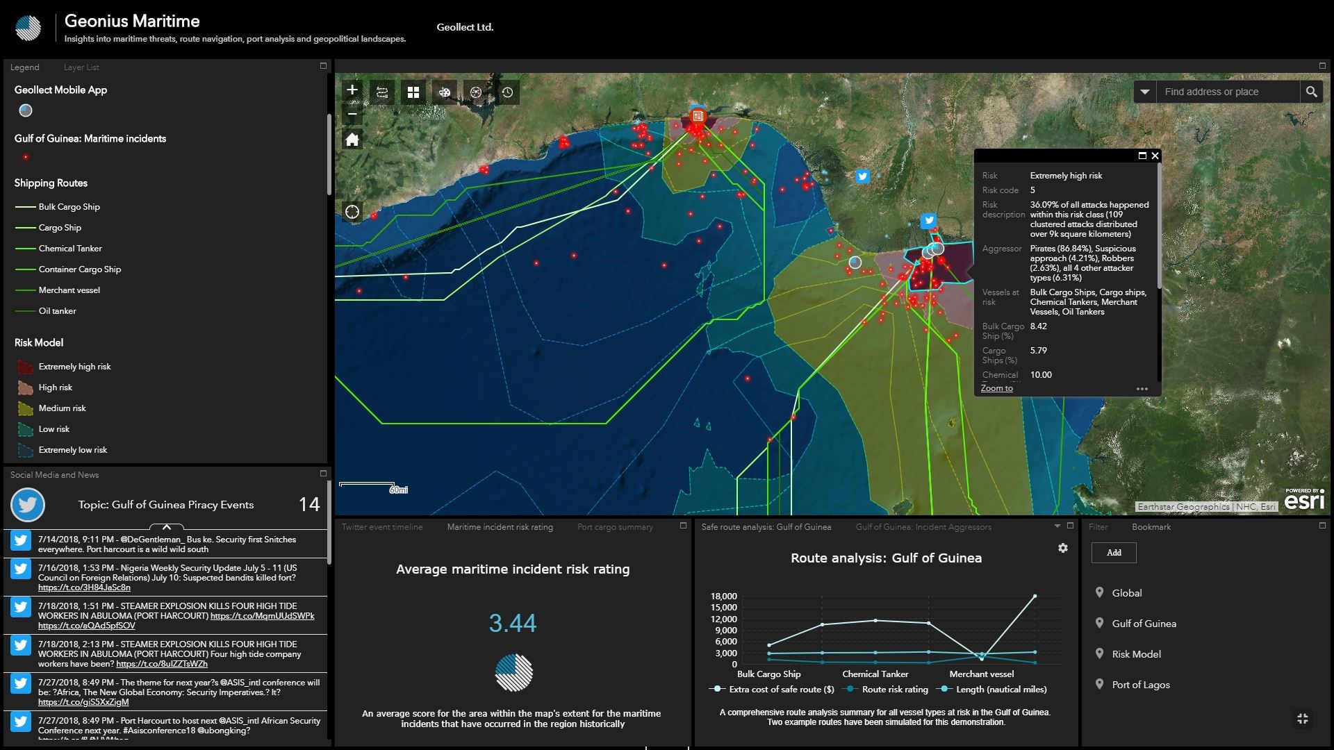
The Geollect web app showing risk models for different shipping routes
“We have created a unique web app for the maritime industry using ArcGIS that gives ship owners, insurers and captains the information they need, all in the same place, to help them understand and reduce risks at sea”