
OGC Services and Custom Parameters
/Most ArcGIS applications work well with Open Geospatial Consortium (OGC) services, allowing you to use the power of ArcGIS alongside geospatial web services from other platforms. Both ArcGIS Pro and the Map Viewers in ArcGIS Online and ArcGIS Enterprise allow you to work with both older WMS and WFS format services as well as those built on the more modern OGC-API Features standard.
We have sometimes seen users having difficultly with OGC Services in ArcGIS when the service needs additional parameters to access it, for example API keys or identifiers. To get the best experience in these situations, make sure you use the Custom Parameters functionality.
For example, Data Map Wales is a shared data mapping platform for members of the public and public authorities in Wales. Browsing the data catalogue allows you copy the WMS and WFS endpoints for each dataset. If you look at the URL you have copied, you will see the URL has a custom parameter which looks like this
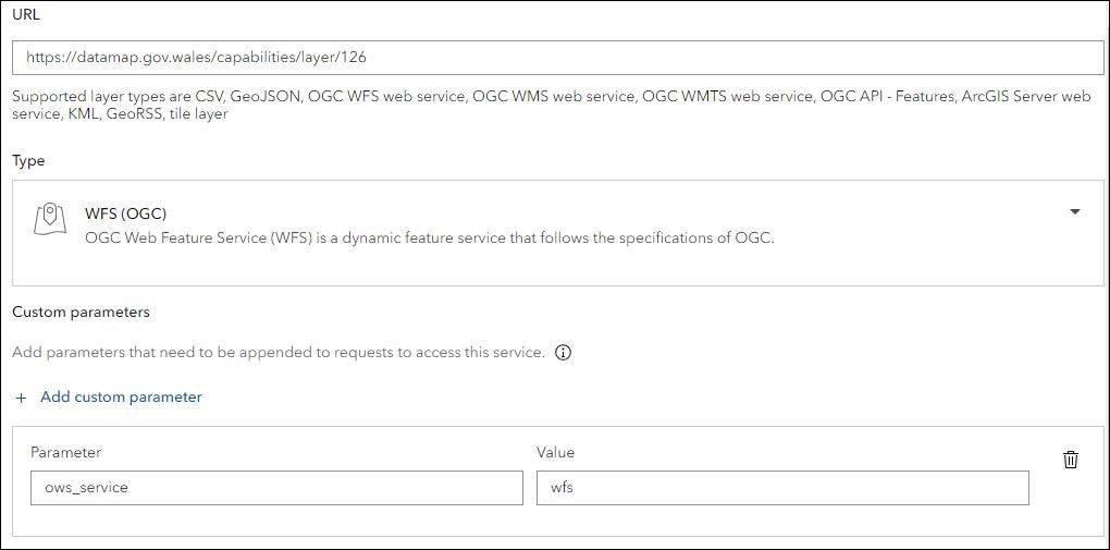
https://datamap.gov.wales/capabilities/layer/126/?ows_service=wfs
To add this layer, which represents Active Travel Approved Routes, to ArcGIS Online, simply add ows_service as a custom parameter in the Add Layer from URL dialog like this:
This allows the data to be viewed and interrogated in ArcGIS Online (or other ArcGIS application), alongside other layers that could be coming from your own ArcGIS system, from Esri’s living atlas, and of course other layers from Data Map Wales. See below for an example.
