
Using the APGB service from ArcGIS
/The Aerial Photography for Great Britain (APGB) agreement is a fantastic service for public sector organisations in Great Britain. It gives the public sector access to high resolution imagery and height data for use in their GIS, CAD and other systems. The data is available either by downloading the source data or as a dynamic WMS service.
The WMS works well in ArcGIS, and provides an interesting alternative to the ArcGIS Living Atlas layers for some use cases: it is in British National Grid and is better resolution (down to 12.5cm). At the time of writing, the latest Living Atlas images of the UK were captured around the same time as the images in the WMS (late 2018). There are downsides - as a dynamic layer, the screen refresh is not as fast as we expect these days from “slippy maps” - cached tiles, so it may not be appropriate for some applications. It also of course can’t be taken offline for disconnected working in the field.
If you want to use the APGB data in a disconnected network or take the data offline on mobile devices, the Esri UK Content Team can provide the latest imagery for your area, cached for optimal performance.
When adding the WMS service to ArcGIS, please use the custom parameters functionality to add in the credentials provided to you by the WMS supplier (Airbus). This functionality is available in ArcGIS Online, ArcGIS Enterprise, ArcGIS Pro and ArcMap. The screenshot below is from ArcGIS Online.
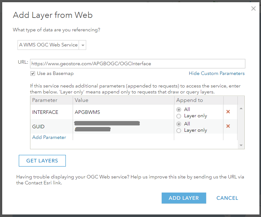
If adding the WMS as a basemap ensure you select only one of the layers when you press Get Layers. If however you add it over the top of an existing tiled British National Grid such as one of the Esri UK Open Data basemaps then you can turn on and off the individual layers in the WMS service. This also allows you to change the transparency on the image to show the basemap underneath. Here is a map of our Edinburgh Office showing the service overlaid on one of our Premium Ordnance Survey MasterMap basemaps.
