We are updating and enhancing our Free and Premium Online Content Services to reflect recent changes in the Ordnance Survey product portfolio and to extend the Free Content available to customers with the addition of 2011 Census data. The following changes will take effect in tonight’s (7th October) update of the Services.
Free Online Open data changes
OS Landform Panorama DTM data has been replaced with OS Terrain® 50.
2011 Census map services for England and Wales have been added.
OS Terrain® 50
This is a new 50M digital terrain model (DTM) built from new capture and flowline designed to use imagery flown for the Ordnance Survey large-scale products to product height data. It offers a significant development for users of OS OpenData™ as for the first time an updated and maintained height data product is available. Sharing source data with the Ordnance Survey large scale products means that the currency of the data is greatly improved over the dataset it replaces – Land-Form PANORAMA®.
The service is a tiled map service with thematic shading and replaces the Land-Form PANORAMA® map service.
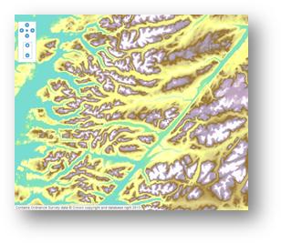
The Land-Form PANORAMA® service will be removed approximately one month from the release of the new OS Terrain® 50 map service.
2011 Census Services
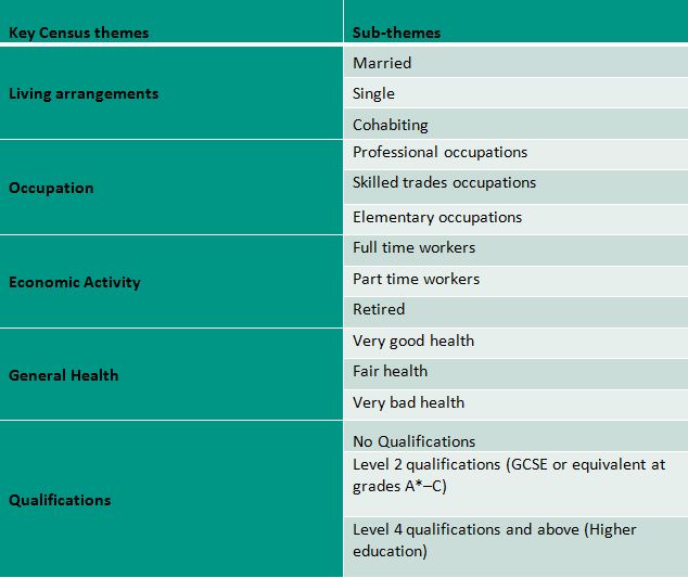
Following the release of the 2011 Census data we are launching a number of Census map services initially for England and Wales. The cached map services cover 5 main themes with 3 sub-themes for each, a total 15 individual map services. The data is thematically shaded using the appropriate level of boundary data for each zoom scale.
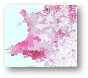
This includes output areas (OA), lower super output areas (LSOA) and middle super output areas (MSOA). The table below shows the themes and sub-themes available.
Premium Online Content Services changes
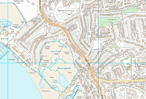
We have made changes to the services to include the addition of the VectorMap® Local (VML) colour raster which will replace the 1:10,000 colour raster from the PSMA data sets in the future as the 10k raster moves to a retired product. For existing PSMA customer the 1:10,000 raster can still be used until at least 31st March 2014, but the data is not being updated therefore the service will not be updated. The VML raster service has be added to all eligible Premium Online Content accounts.
OS VectorMap® Local Colour Raster
VML is a detailed raster map appropriate for viewing at large scales and is generated from the vector version of VML. It takes the place of the 1:10,000 colour raster for large scale raster datasets, although the 1:10,000 raster service is still available to eligable Premium customers but not updated.
Accessing the new services
All existing customers with free or premium accounts will have the new services added to their accounts. They will be accessible in the normal way – via the ArcGIS desktop add-in, direct using the service URL or through the REST Endpoint.
Terms and Conditions
Please note the Esri UK Online Service Terms have been updated at section 12.1.2 to incorporate terms for accessing ONS Census data. The terms can be found here.
If you have any queries or feedback regarding the Esri UK Online Content as a Service, or wish to discuss any Content requirements or analysis services please do not hesitate to contact the Content Services Team.
Content Services Team
content@esriuk.com