Esri’s I3S 3D data format has just been approved as a Community Standard by the Open Geospatial Consortium (OGC).
What is I3S?
The Indexed 3D Scene (I3S) service and its sister format the Scene Layer Package (.SLPK) are designed for the storage and visualisation of ‘arbitrarily large’ 3D datasets. I3S works as a web service and .SLPK is the corresponding file format. Layer types include 3D Object, Integrated Mesh, Point Cloud* and 3D Point features. The performance of these has to be seen to be believed. Click through to explore the following scenes:
3D Object
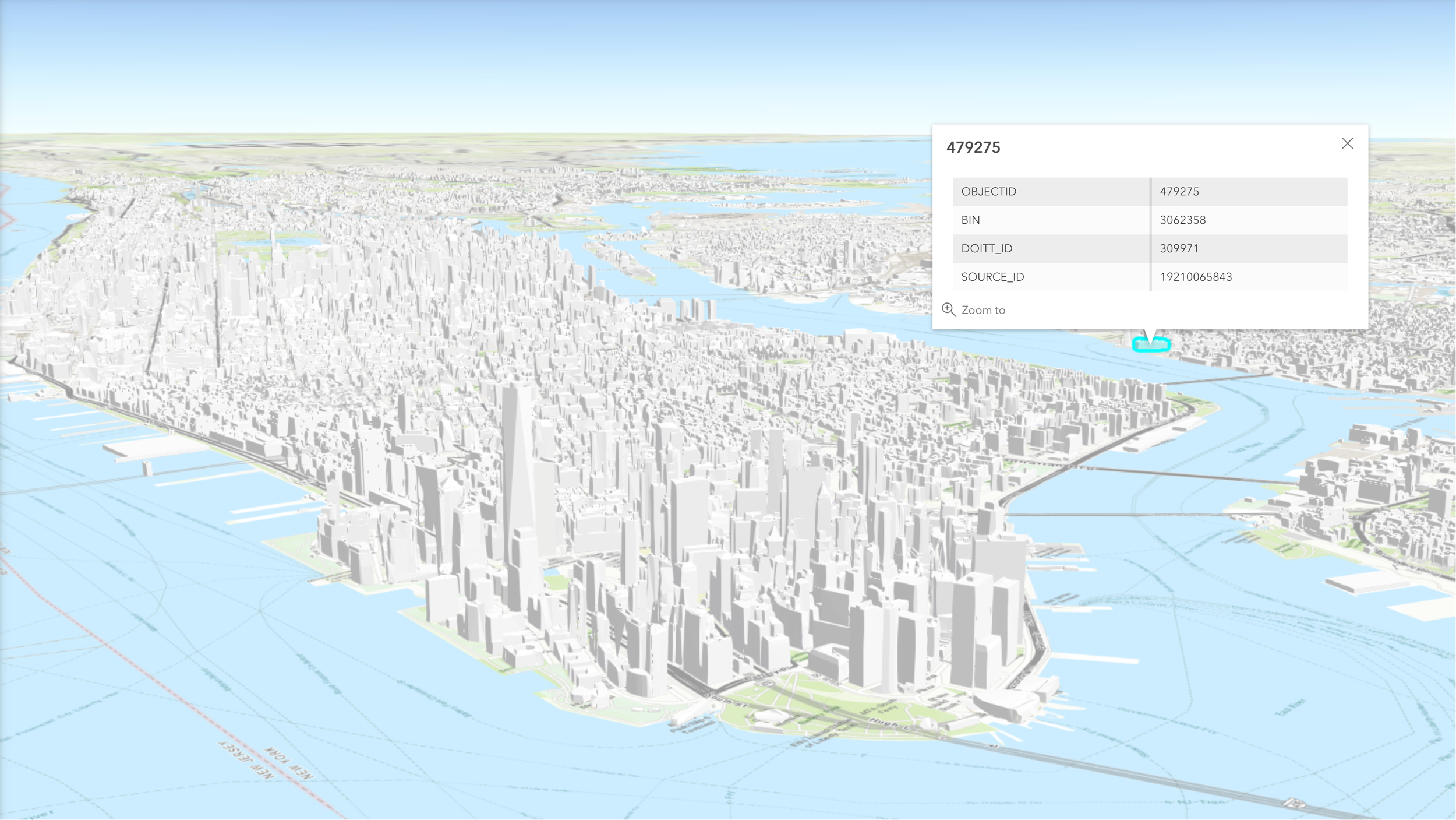
3D Object layers, such as this one of New York City, contain discrete 3D geometries with individual attributes.
Integrated Mesh
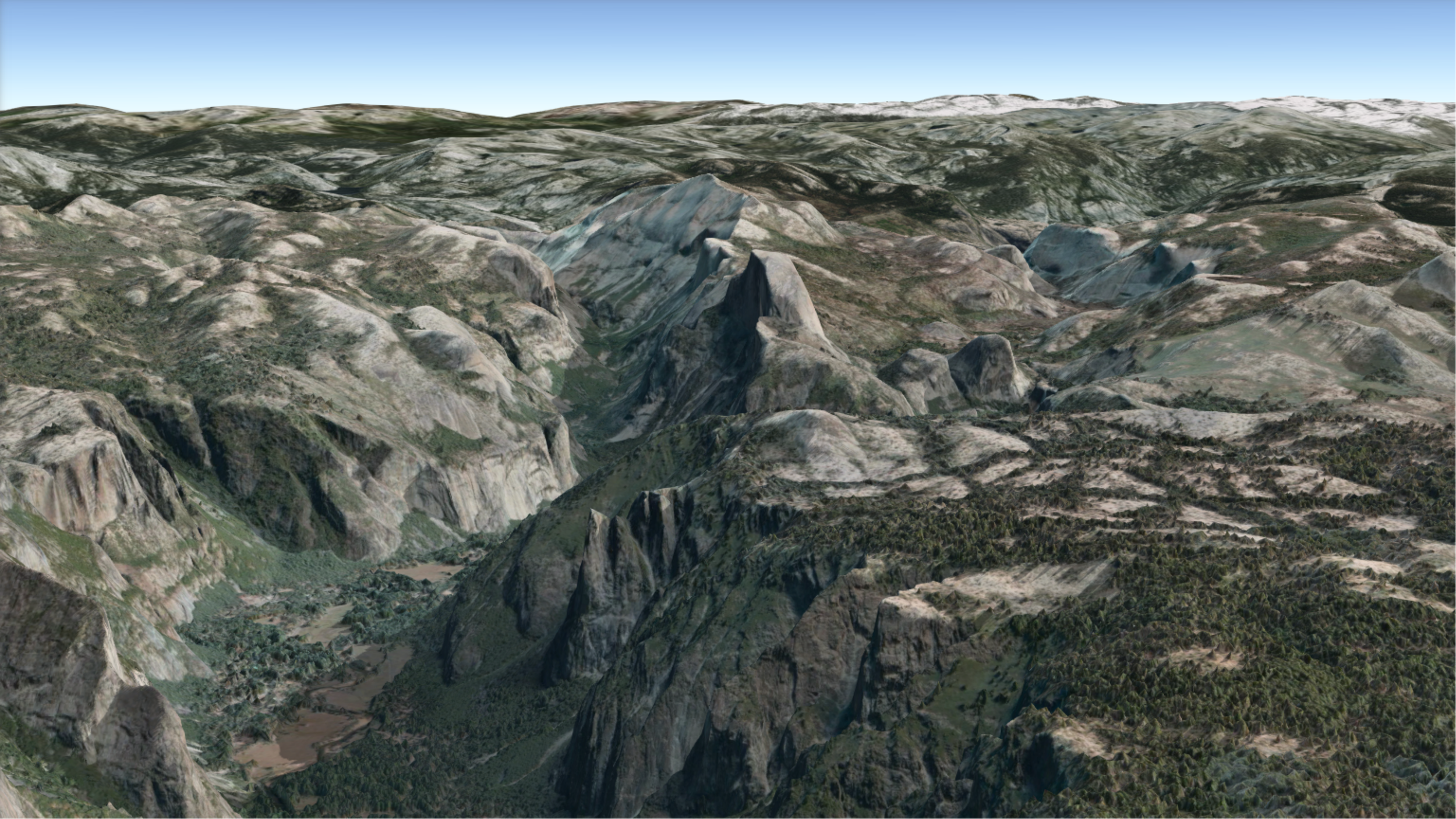
Integrated Meshes are continuous surfaces. This mesh from VRICON shows detail of Yosemite National Park in California.
Point Cloud
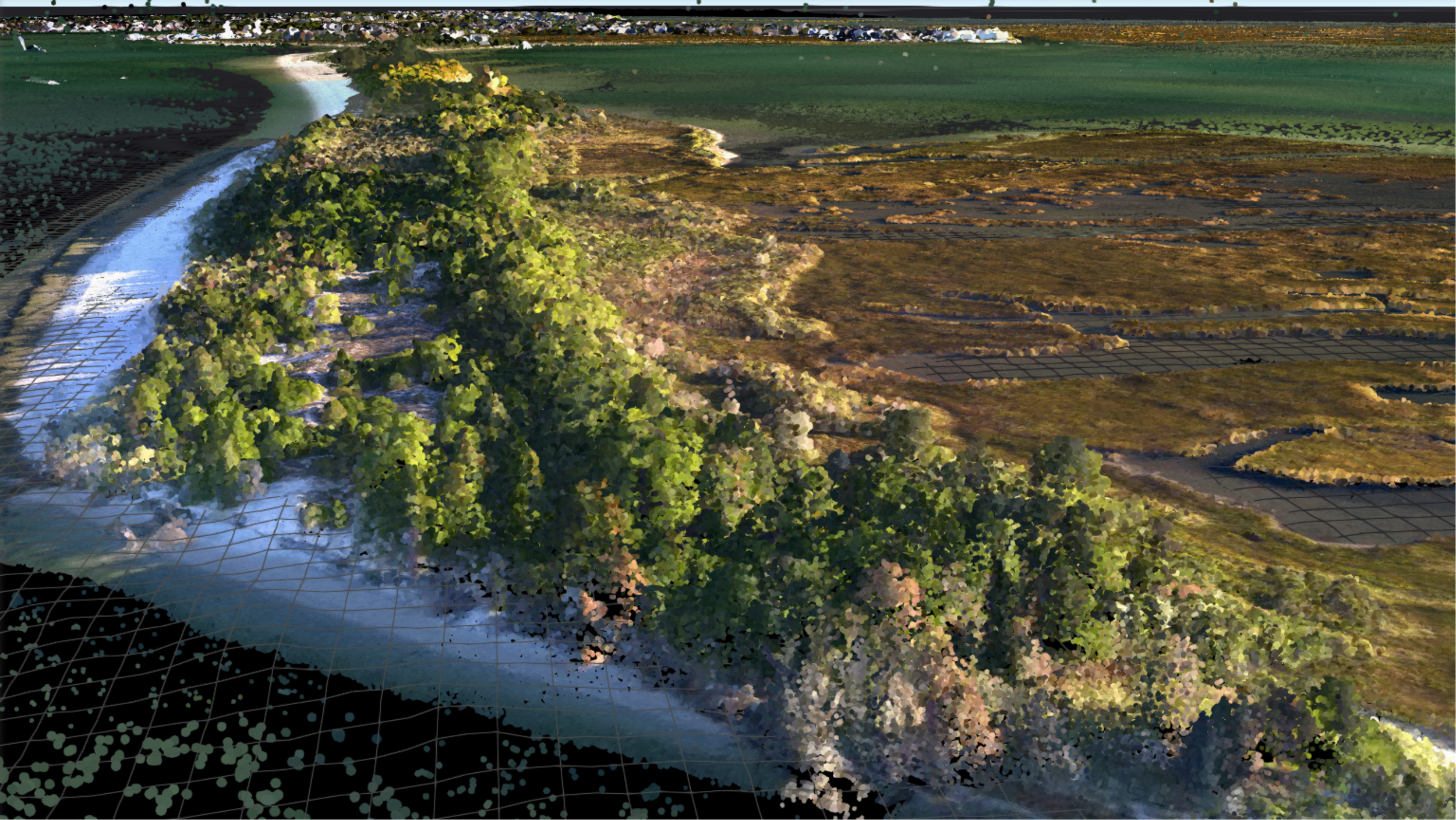
Point clouds are most commonly created by LiDAR capture, or generated from images using tools like Drone2Map. The data in this scene of Barnegat Bay, New Jersey contains over 1 billion points.
3D Point
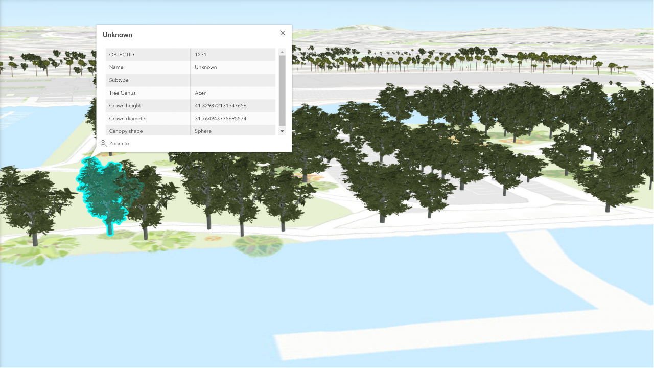
3D Point layers consist of point geometry with attribution. They can be styled using data-driven symbology or with realistic 3D models, as in this example from San Diego.
Design
User experience, scalability and web-friendliness are core design principles for I3S. This means a clever implementation which only loads data that is visible from the user’s perspective or camera position. It also means supporting multiple levels of detail for each object, so that no bandwidth is wasted by loading the detail of brickwork on a building in the far distance. This efficient approach enables management of datasets containing millions or billions of objects.
These formats have been developed openly from day one, and the full specification is available on GitHub. However, the beauty is that you don’t need to understand everything that’s going on behind the scenes. You can start creating I3S content using a compatible tool like ArcGIS Pro or Drone2Map. Alternatively, our content team can provide advice on readily-available 3D datasets for use in Pro, ArcGIS Online or ArcGIS Enterprise.
Seeking Approval
Acceptance by OGC as a Community Standard is official recognition of I3S as a de facto standard. In other words, it is designed and developed outside of the OGC itself but has become accepted through widespread implementation and community approval. The GeoRSS format is another notable example of an OGC Community Standard.
So What?
The OGC is an internationally-recognised standards body responsible for widely-used formats such as the Web Feature Layer (WFS) and Web Map Service (WMS). This approval cements the I3S format as a foundation for open innovation in a key growth area of geoscience. Other products using I3S today include ContextCapture (Bentley), Vricon and Pix4D.
For the dedicated reader, the full OGC specification can be found here.
* Point cloud support has been implemented in ArcGIS, but is not in this version of the OGC Community Standard
![]()