With swarms of crowds heading to the beach, we asked ourselves ‘how many people can you really fit on the beach, at a safe social distance?’ The answer: a lot less than the current crowds! This blog will outline the steps taken to calculate the socially distanced bubbles, using ArcGIS Pro.
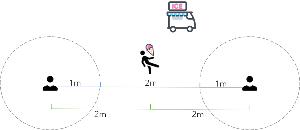
For this analysis, we wanted to create ‘bubbles’ that allow for effective 2-metre social distancing. To further our analysis, we factored in the ability to navigate between bubbles, otherwise how else are you going to fetch your ice creams?! The graphic below illustrates our desired output (with an exceptionally large ice cream).
The following steps explain how we created the bubbles:
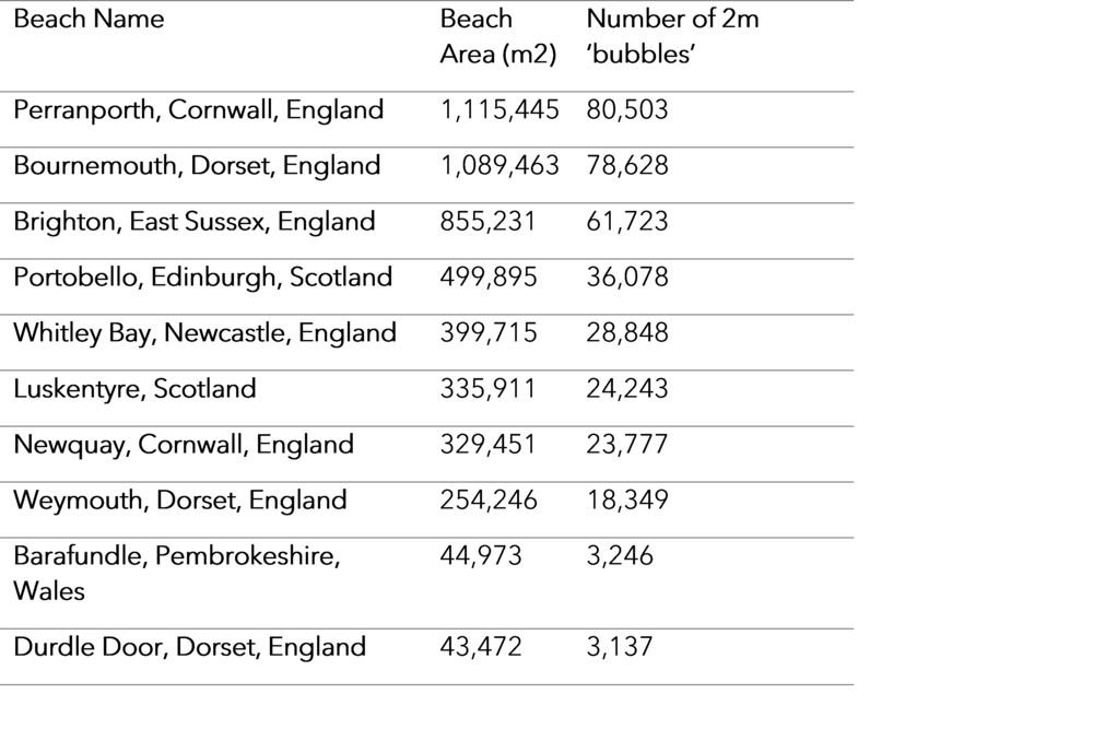
Step 1: To begin, we identified 10 popular beaches across the UK and calculated the area of dry sand on each, using the MasterMap Topography Layer® from Ordnance Survey (OS). To achieve this, we combined the categories of ‘sand’ and ‘foreshore’ to define the total beach areas at an average high tide.
Step 2: Using the Generate Tessellation tool, we created a series of hex grids across the beach area. To create a 2m apothem, the area of the Generate Tessellation tool area is defined as 13.856m2.
Step 3: We then used the Feature to Point tool to identify a point feature in the centre of each hexagon.
Step 4: Using this point feature, we created a 1m buffer using the Buffer tool. This results in a series of evenly spaced circles representing a social distance, with a 2m gap between each circle (for ice cream trips).
Step 5: We then clipped this buffer output to the beach area and removed the hex grid.
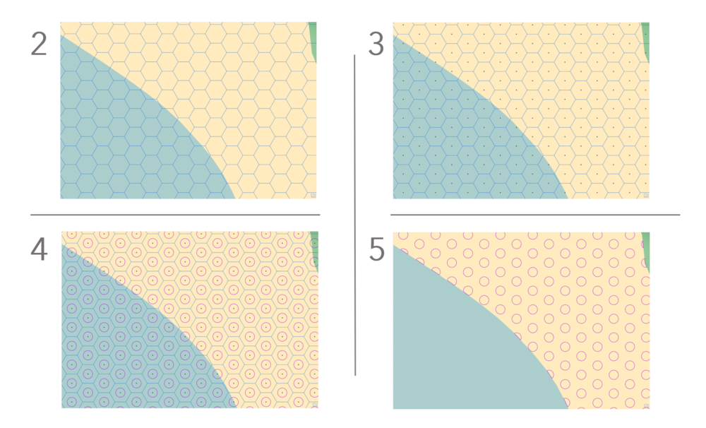
STEPS 2, 3, 4 & 5
Step 6: To give the bubbles further spatial context, we draped them over a basemap, customized using the vector tile style editor. This allowed us to create an easy to read map with a clean and simple design. To finish, we added hillshade to basemap to emphasise the changes in elevation. The final results can be seen below.
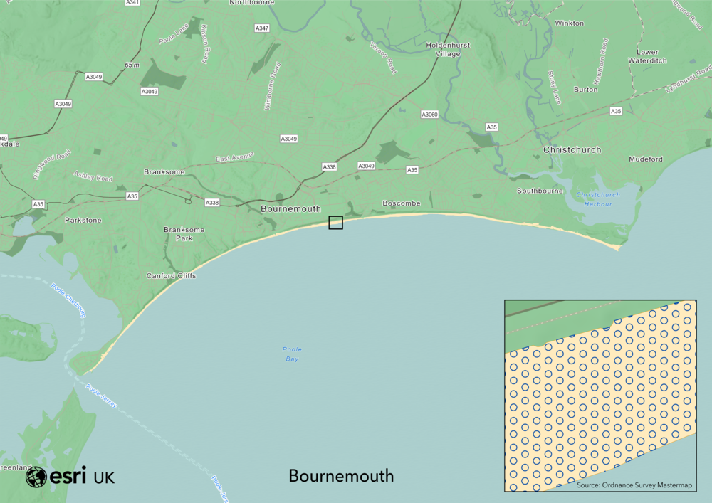
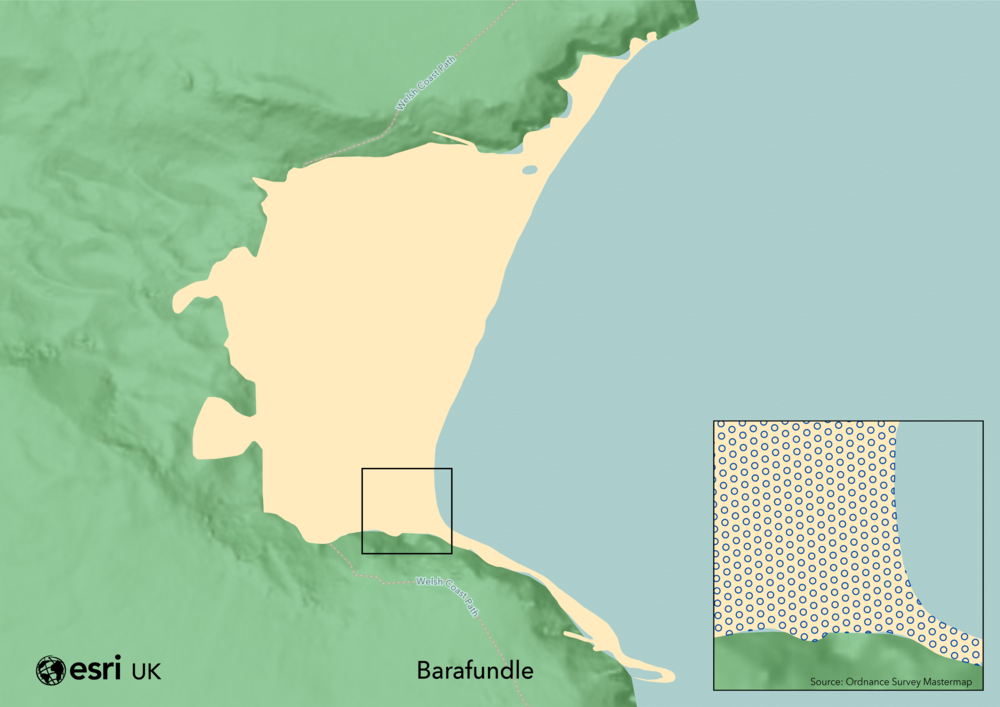

NUMBER OF BUBBLES FOR 10 UK BEACHES