The more we use ArcGIS Online, the more content we add to our organisations and this starts to create a ‘good’ problem – knowing what content we have at our fingertips… How could this be made easier? The previous update introduced the ability to deprecate content or mark it as authoritative which is a good start. Now, with this update, we get the ability to define categories to help make content easier to discover. The categories are managed at the organisation level to maintain consistency and there is a new administrative privilege to allow you to choose which of your custom roles can manage the categories.
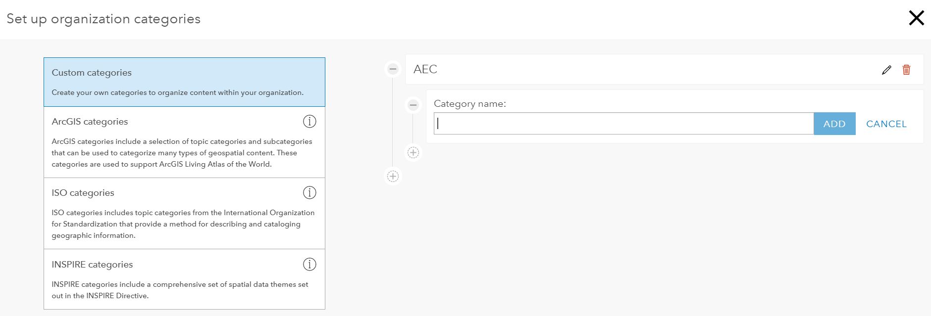
You can create your own set of categories and sub-categories or start with one of the pre-configured sets: ArcGIS, ISO or INSPIRE. If you do use one of these it will add the full structure but you can then modify it.
There is also a new gallery page that has new options for searching, sorting and filtering what is in the gallery – which can make use of your new content categories. The gallery is now only available to logged in users.
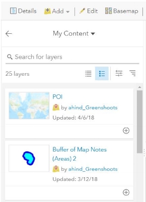
Finding the right layers to add to your new map gets easier with new options in Search for Layers and Browse the Living Atlas. You now have a choice of views for the results including a list, list with thumbnails and a table view. There’s also the option to sort and filter the results. If you are adding layers from a GIS server this has now moved to Add layer from the Web.
Other new features
If you’ve used the Predominant Category and Predominant Category and Size styles but wanted to go beyond five considered attributes, the limit has been pushed out to ten.
The performance of 3D scenes continues to improve, with scene layers using less memory. If you are using large datasets you may see the new memory management features kicking in and controlling memory usage across layers according to the quality settings.
The Scene Viewer is now supported on mobile devices, so you can view 3D content on a modern phone or tablet through the browser.
If you’ve used 3D, particularly for buildings, you may have found that adjacent multipatch features are hard to distinguish. You can now enhance your scenes with edge rendering.
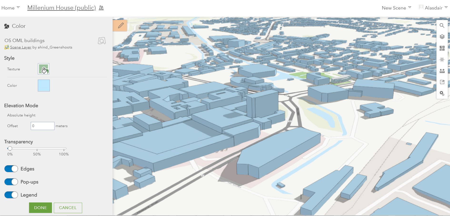
You’ll need to go into the layer drawing style options and activate it for each layer. Don’t forget to save the scene.
To see the full list of features, including new options for appending data and publishing from cloud drives, please read the what’s new page.
![]()