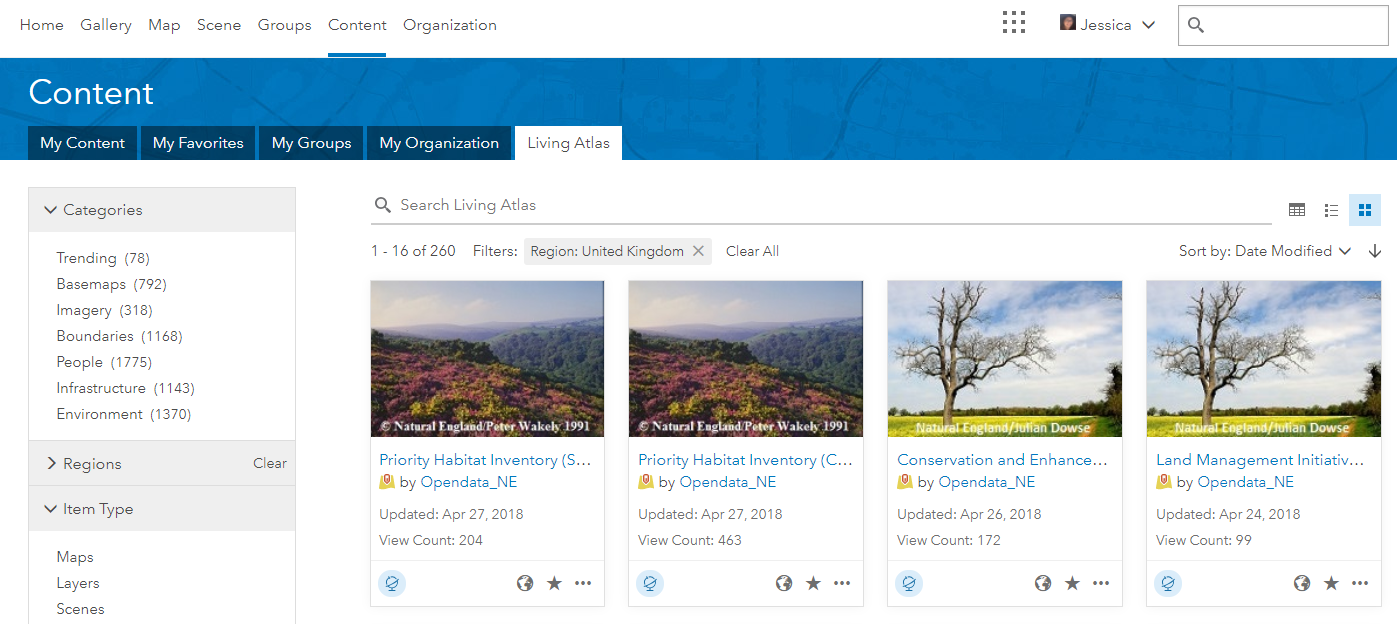
The Living Atlas of the World is a global collection of geographic information from around the world. You can find maps, apps, and data layers from a range of new categories such as basemaps, imagery, people, boundaries, infrastructure and environment.
We’ve been adding lots of content into The Living Atlas (see our previous blogs for Office for National Statistics data and Canal and River’s Trust data) and challenged ourselves to run a site suitability analysis using Living Atlas datasets. But there have also been changes in ArcGIS to make working with the data even easier, so I thought I’d share the different options.
ArcGIS Online
The April update to ArcGIS Online allows you to access Living Atlas data within your Content tab. This is a great place to take a look at what is in the Living Atlas and you can add any layer into a new web map.
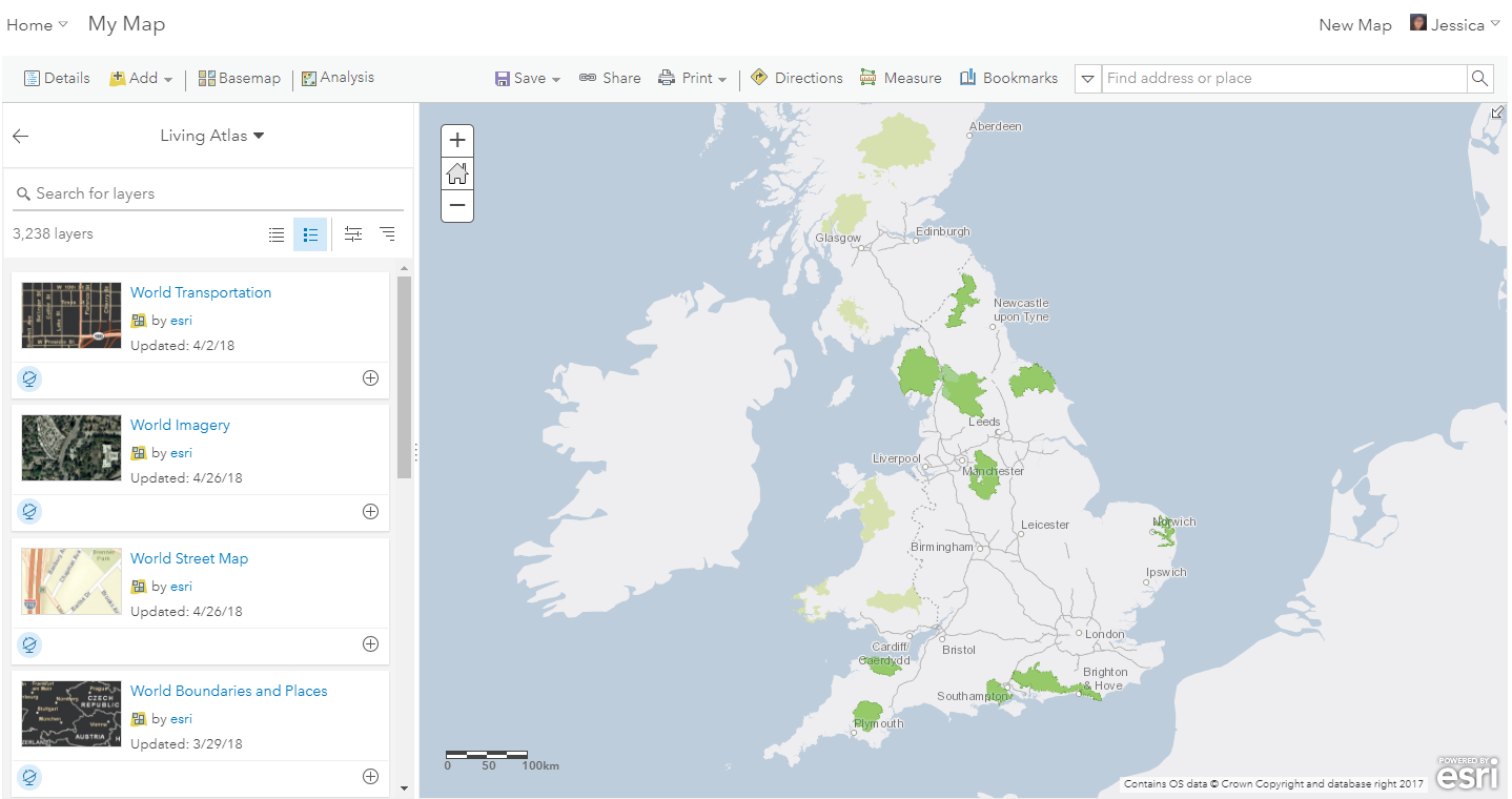
Or, if you already have a map, you can add Living Atlas data within the web map by clicking Add and Browse Living Atlas layers.
ArcGIS Pro
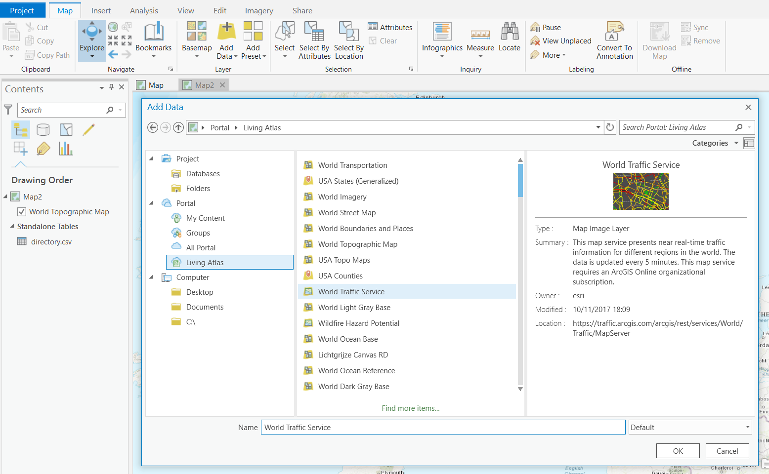
Adding Living Atlas data into ArcGIS Pro is just as easy, with different options to choose from. You can add in Living Atlas data the same way you’d add in your own data by clicking on Add Data and choose the Living Atlas tab.
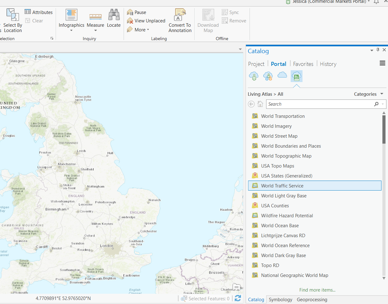
You can also add in Living Atlas data through the Catalog pane by clicking on the Living Atlas button.
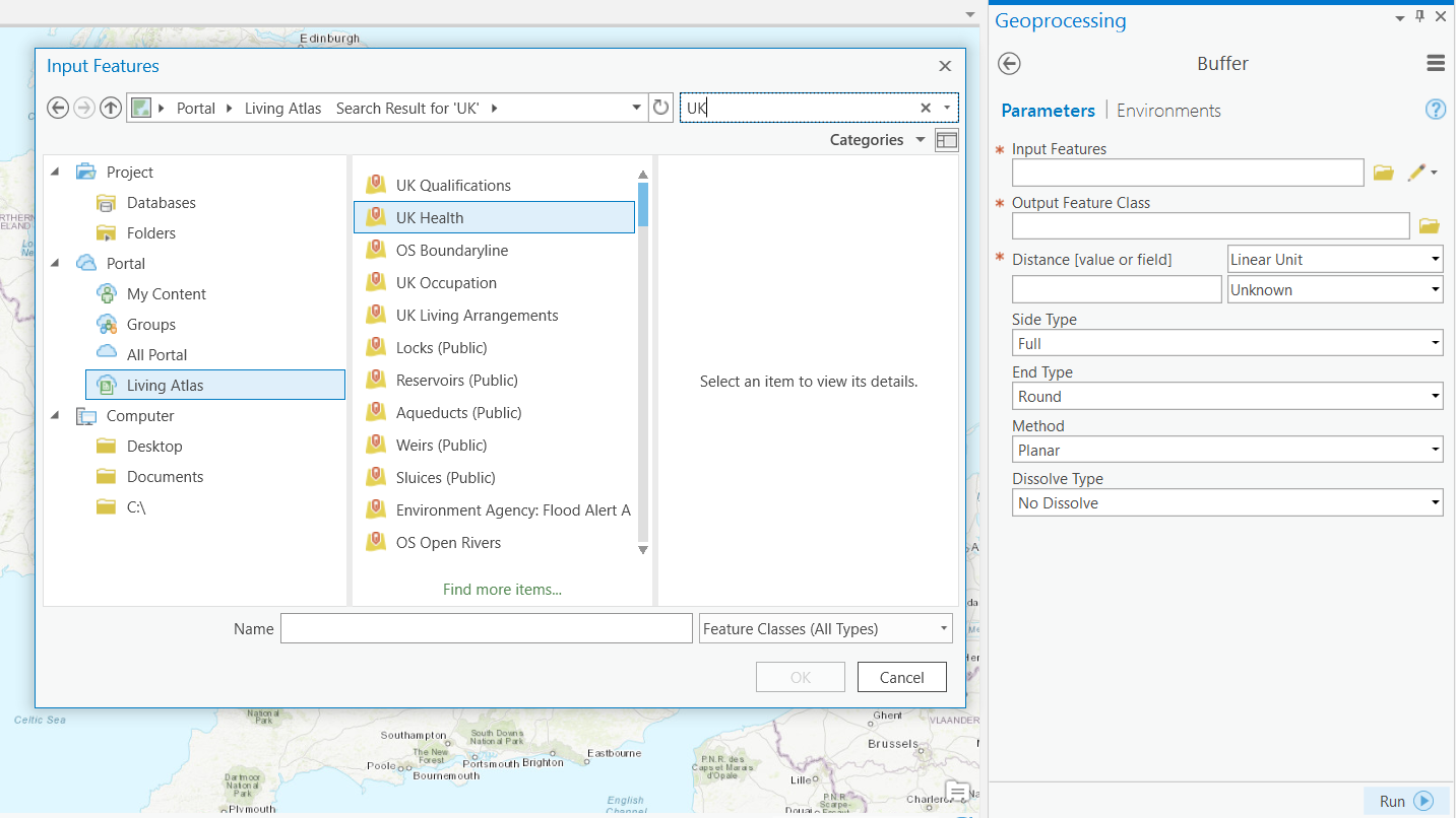
If you want to use Living Atlas data directly for analysis in ArcGIS Pro, you can do that too. Say you need to run an environmental check to make sure your new site isn’t within 500m of a SSSI. In the geoprocessing tool dialog, click on the folder for Input Features and select the Living Atlas tab – then search or browse for the SSSI data.
Apps
The opportunity to access Living Atlas data doesn’t stop there. With most ArcGIS Apps, you can simply do this by adding a web map including Living Atlas data into an App. For example, you can add the World Traffic Service into your Collector app if you need a visualise traffic speeds.
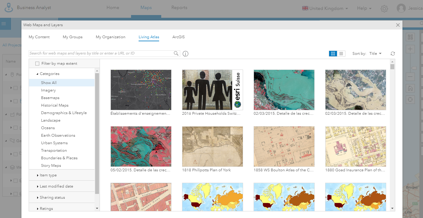
You can also directly pull in Living Atlas data in Business Analyst Online. To do so, navigate to Web map and layers box from Add Data and select Living Atlas. For example, you could add in the Office for National Statistics’ administrative boundaries to enrich your own data and further your business insight.
The Living Atlas continues to grow- check out the recently added Firefly Demographics – so keep an eye out for new data. If you want to submit your data to the Living Atlas, all you have to do is navigate to My Contributions on the Living Atlas page and start nominating!
![]()