The latest update for ArcGIS Pro, Esri’s flagship desktop application has arrived. With so many new features, even the most observant eye might miss some of the exciting advances that have been made in this most recent update. This blog will take you through my selection of the new tool developments and features in ArcGIS Pro 2.1.
Mapping and visualisation
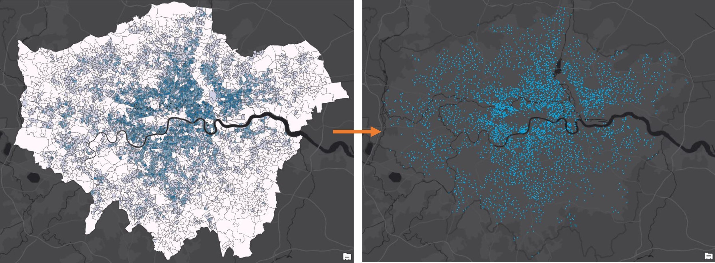
Dot Density symbology is the newest addition to the symbology options. Previously available in ArcMap, Dot Density symbology is used to draw quantities within polygon features. Each polygon is filled with dots, with each dot representing a single value. For example, by using census polygons with population counts, 1 dot represents 10,000 people, as seen in this example.
An exciting new feature in layout views is the ability to add dynamic tables. This lets you capture complementary information about your map and by setting a map extent, you automatically update what is shown in the table. You can set the order of fields, their spacing, and the symbols for headers, rows, and columns.
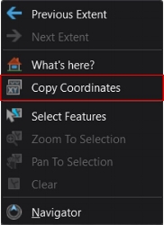
Perhaps one of the subtlest of improvements to the way in which you can now interact with your map, comes from just one right-click of your mouse. ArcGIS Pro now has a Copy Coordinates option, making location research quick and effortless.
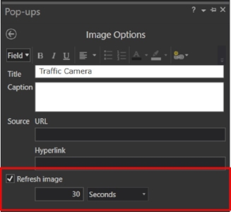
Pop-ups let users access linked images for a location but there was no option to refresh the image while the pop-up is open. Now, updated server images can automatically refresh independently of the manual interval set for the whole layer. This can be found in the Configure Pop-ups pane.
Added support for WFS connections in ArcGIS Pro has extended the end user experience of online web map and web layer services. Adding a WFS connection via the insert tab enables you to then drag and drop web services directly on to your map.
3D
A brand-new addition to the Analysis tab just made working with your 3D data that much easier. There are now three interactive 3D Exploratory Analysis tools, available from the analysis tab within a 3D scene or 3D map, including Line of Sight, Viewshed, and View Dome. Each tool allows for a quick and interactive analysis, whilst the analysis objects themselves can be exported and reloaded again for future use. What’s more, the 3D Exploratory Analysis tool pane lets you set vertical offsets for the observer. If you knew the exact height of a person, you can be confident that you are seeing what the world would look like through their eyes.
 Line of Sight
 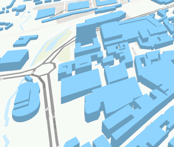 VIEWSHED
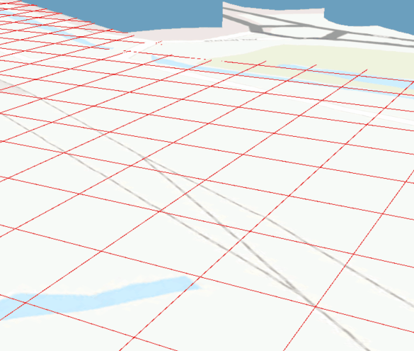
An Editing Grid option now graces scenes. Turning on the editing grid helps you edit your 3D data more precisely. The editing grid can be set independently of any coordinate system, allowing you to rotate and move the grid.
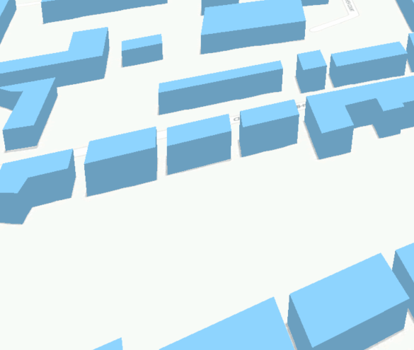
Perspective and Isometric drawing modes introduce an alternative for projecting 3D data, which can be found on the View tab. For realistic projections of our 3D data, use the familiar perspective mode, but for technical engineering drawings and scientific visualisation, isometric projections are the way forward. Isometric drawing means that you can visualise an object such as a cube, where by all the angles between the projections of the x, y and z axis are the same. This is valuable for architects needing to take direct measurements.
Analysis
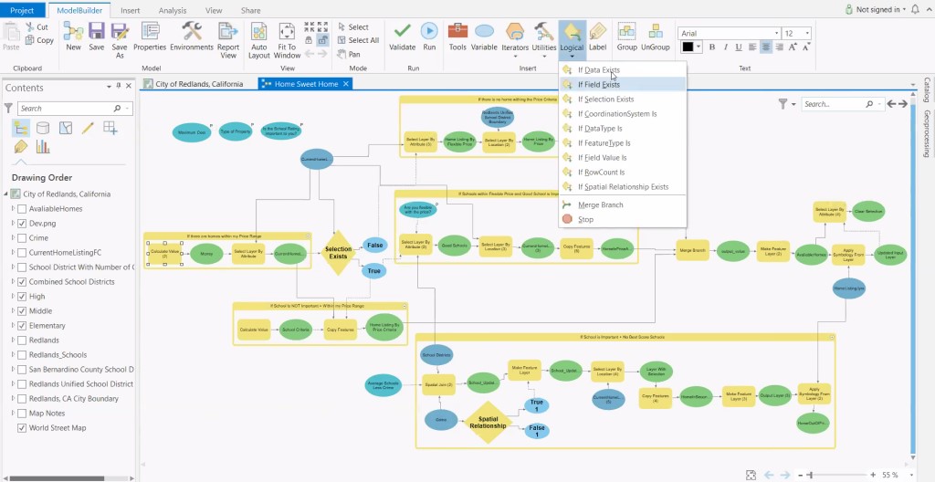
Model Builder’s functionality has been dramatically elevated by the introduction of logical tools. A set of 9 logical tools support conditional statements, such as if-then-else branching, controlling how a model should proceed with the data it’s processing. This allows models to include multiple options, choices and alternatives. Below is an example of a model that seeks to find the ‘perfect’ home, within conditions set by the branching logic.
ArcGIS Pro has also introduced a significant improvement to the management of geoprocessing actions. Several geoprocessing tools that either modify features or attributes now have a Start Editing option near the run button. When this option is checked before running a tool, an editing session is started. This means that the tool processing occurs within the edit session, giving you the possibility to undo the action taken by the tool.
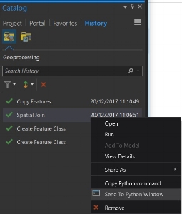
One of the great things about ArcGIS Pro is that the geoprocessing history is stored against a project. A dedicated Geoprocessing History tab has been added to the Catalog pane where you can now search, filter and sort items in your geoprocessing history. If that wasn’t enough, you also have the option to Send to Python Window, which automatically opens the Python Window and copies the tools command into the interpreter box.
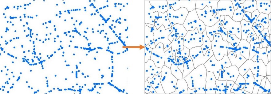
Generate Subset Polygons is a new tool in the Geostatistical Analyst extension, which allows you to generate nonoverlapping subset polygon features from a set of points. This is particularly useful for using subset polygon features in EBK Regression Prediction, an approach that combines kriging with regression analysis to make statistical predictions.
Data and Content Management
Instead of using the dedicated Add Data button or adding data through your Catalog pane, you can also now drag and drop datasets such as CSV’s and tables onto your map – straight from Windows Explorer.
If you have closed polyline features, such as land boundaries, you can automatically construct polygons from them using the Construct tool. It’s accessed through the Modify Features pane.
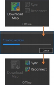
You may notice an additional group of functions on the map tab in Pro 2.1. If you use your laptop to work in the field, you can now download maps from your online portal and take a map offline. You can then Sync any changes made out in the field once you have established an internet connection, much like syncing with Collector for ArcGIS. By clicking Reconnect, the map will remove replicas but keep any changes. If you attempt to reconnect without syncing, a pop up will remind you to sync first to update the map.
ArcGIS Pro 2.1 has lots to offer in this update; from subtle improvements to brand new features and tool sets. This blog is only a snapshot and there’s lots more to explore. You can take a look at the What’s New page to see the full list of changes. The ArcGIS Pro development teams have put together videos to show the new features i action and you can these here.
![]()