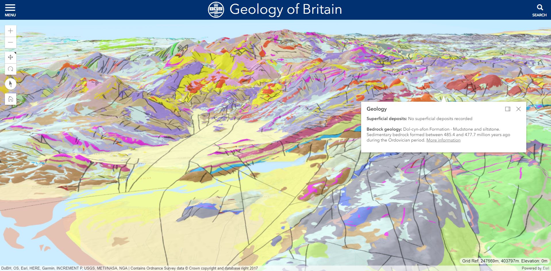
The British Geological Survey (BGS) has released a 3D version of the popular Geology of Britain map viewer. Now you can dive beneath the ground surface and explore the geology beneath:
The viewer was built using version 4.x of the ArcGIS Maps SDK for JavaScript and I was asked if I’d share my experience of using the new API.
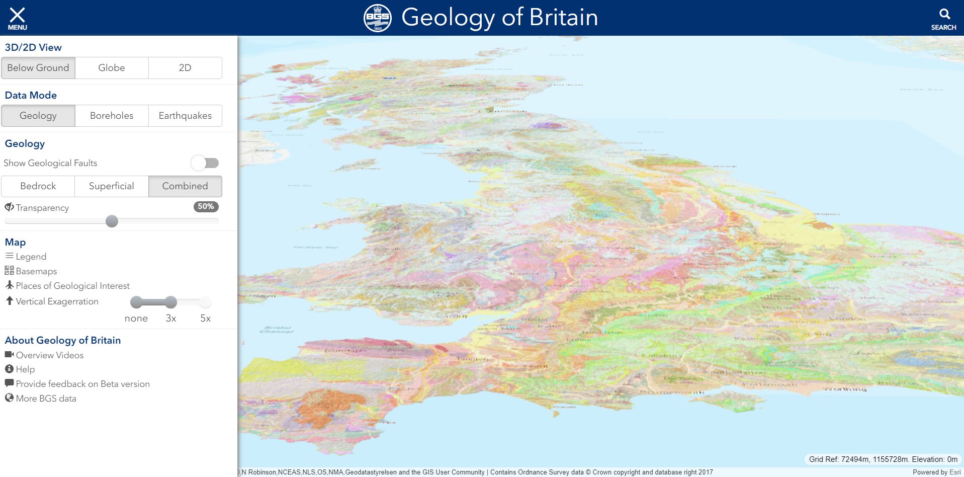
Key features of the viewer include the ability to tilt the map and fly through the UK – viewing bedrock and superficial geology draped over an elevation surface.
You can also view subsurface features including:
- Geology cross sections
- Earthquakes located at their correct depth.
- Boreholes symbolised by sticks representing borehole depth.
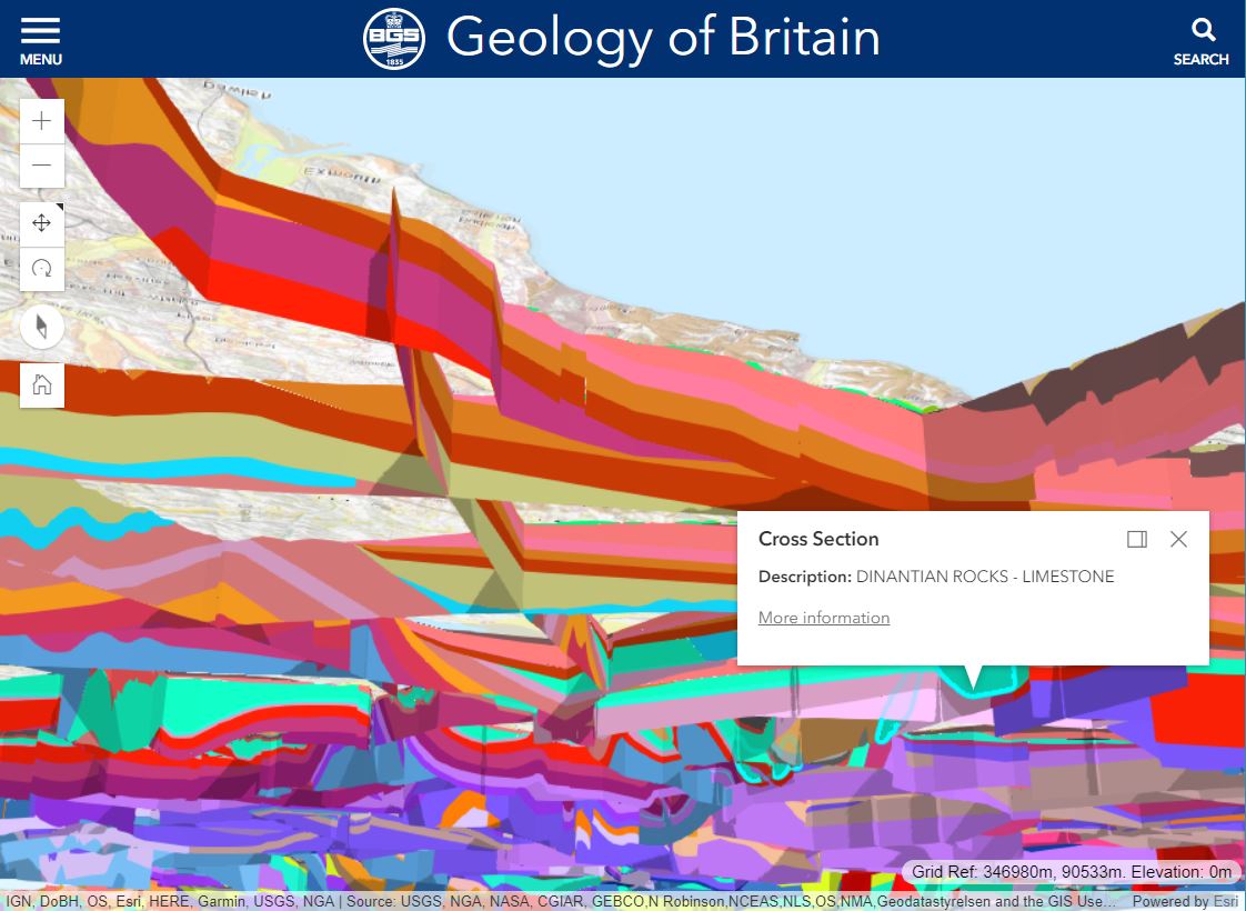 GEOLOGY CROSS SECTION
 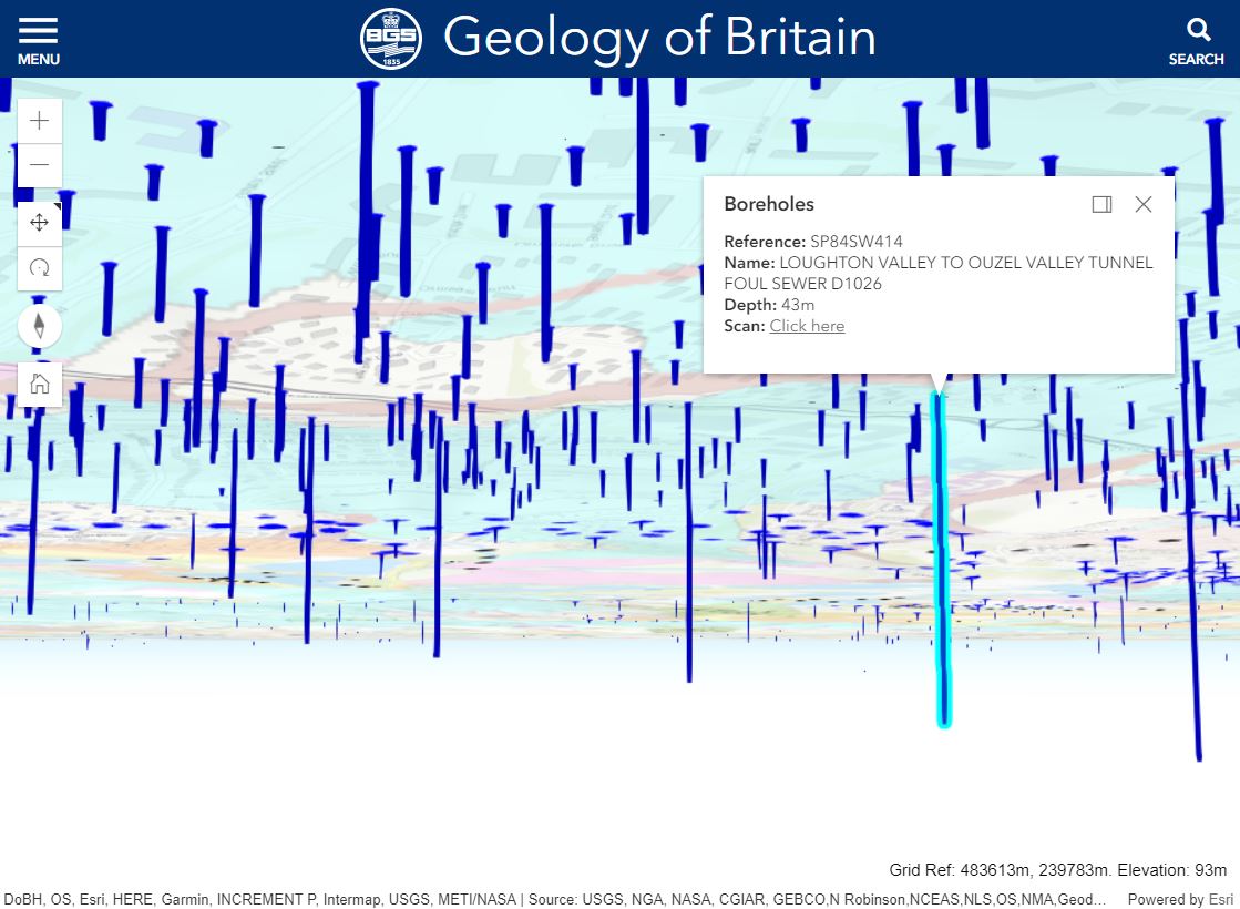 BOREHOLES
 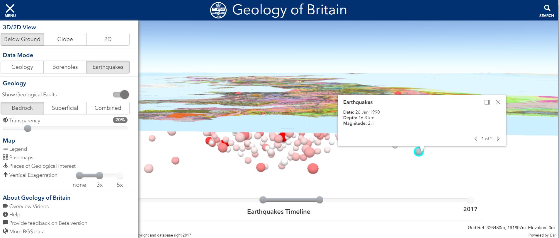 Earthquakes
The starting point for the viewer was to author data using ArcGIS Pro and publish the results to ArcGIS Online. Data layers include:
- Elevation Layers to provide custom elevation surfaces with vertical exaggeration.
- Tile layers for the surface geology datasets to provide high-performance rendering of map data.
- Feature layers to support querying of the geology data.
- Scene layers to display complex 3D features such as the subsurface cross sections and borehole sticks.
Working with version 4.x of the ArcGIS Maps sdk for javascript
After several years of developing map viewers using the 3.x versions of the API, this was BGS’s first attempt at using 4.x and working with 3D functionality. Migration was relatively straightforward with 4.x providing a simpler and more consistent developer experience. Particularly powerful was the simplicity of using a single instance of the Map class to include both MapViews (for viewing data in 2D) and SceneViews (for viewing data in 3D). Interaction with 2D and 3D data in both views is handled in a consistent way, making it straightforward for developers with little 3D experience to quickly develop impressive 3D visualisations.
The API relies on WebGL for 3D views, so unfortunately the viewer doesn’t work on a mobile device. Other functionality we would like to see in the API is the ability to make the ground surface transparent allowing subsurface features to be viewed from above.
The 3D Geology of Britain viewer is currently in Beta and includes a link to provide comments. BGS are keen to receive as much feedback as possible as they intend to release updates over the coming months.

Andrew Marchant, British Geological Survey
![]()