Catching up on the videos from the Esri User Conference in San Diego is a great way to see what’s new and what’s coming. For me though, the highlight is the customer stories – seeing how the capabilities of ArcGIS are applied in real world situations. This year the story that caught my attention was from Kalmar County Museum in Sweden. Ok, so it featured one of my personal interests, history, but it also referenced a couple of my professional interests – 3D and drones. It does have nice examples of these but it is also a great example of the wider ArcGIS platform making it easier to capture, manage and share information. For that it is my standout presentation from this UC (last year it was the airport one).
If you’ve watched Jack Dangermond’s recent presentations you might have heard him talking about GIS fulfilling two high level functions in an organisation: as a System of Record and as a System of Engagement. This duality is a growing trend and the story of the excavation at Sandby Borg ring fort shows how it can work. Accurate recording is a fundamental part of field observation and Kalmar County Museum developed a new methodology for instant field documentation using ArcGIS. As well as significantly streamlining their field excavations, the new approach made information from the dig available much sooner. They were then able to use ArcGIS to share the information with stakeholders and the public on their website (including a 3D scene, an interactive finds map and a storymap). Their 3D map of the site (scroll down the main page) had me engaged…
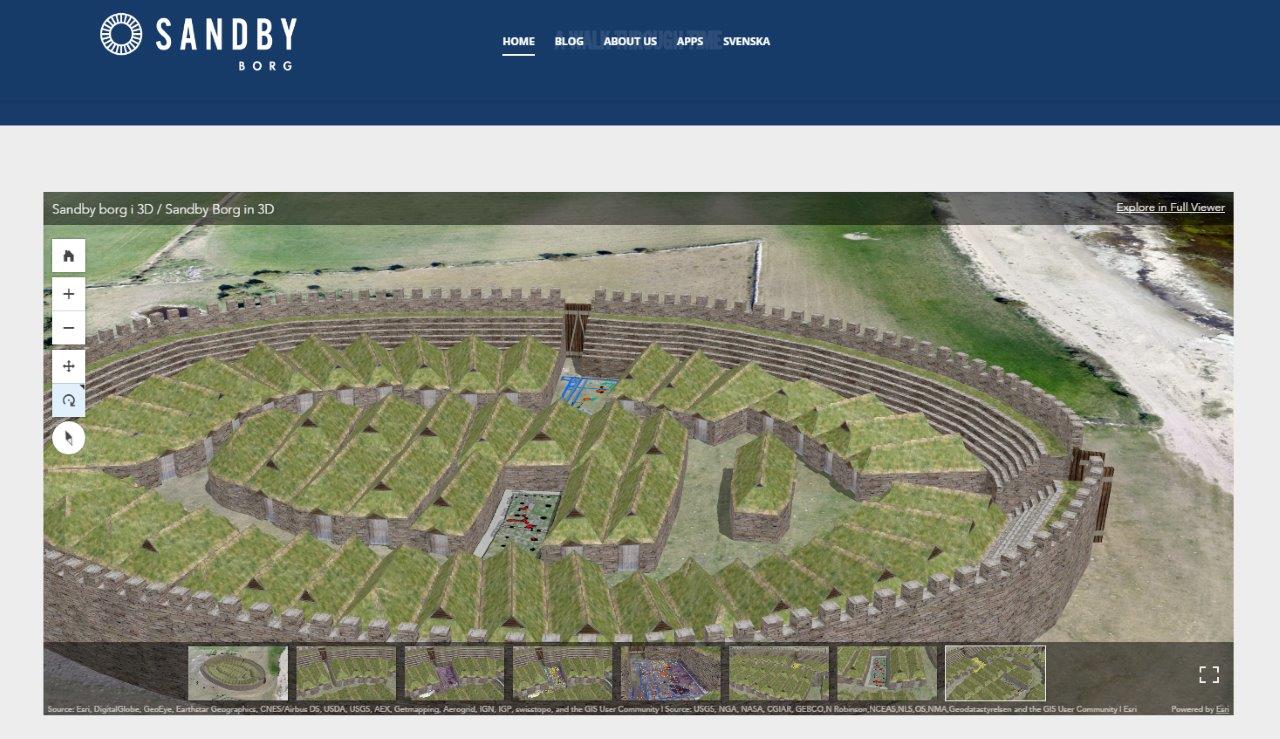 © 2016 – All Rights Reserved – Sandby Borg by Museiarkeologi Sydost
GIS as a vehicle for engagement, as well as analysis, also featured in the opening plenary of our Annual Conference back in May. Foster and Partners showed a range of visualisations from different projects, before talking about using ArcGIS apps to engage their stakeholders – taking GIS data out into the city of Jeddah to show how planned metro stations would fit in.
Oh and if you are still wondering what a GIS enabled dog is, you really should watch the Kalmar County Museum video… …but it involves Collector for ArcGIS running on a Leica Zeno.