 Elevation Layers in ArcGIS Online
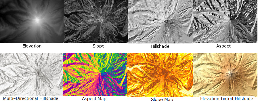
Esri’s commitment to providing high quality spatial Content available in the ArcGIS Platform continues with the exciting new release of Global Elevation data services. There are two dynamic services available (Terrain and TopoBathy), and a number of derived layers such as hillshade, slope and aspect as well as dynamic layers for analysis.
The dynamic layers provide users with the ability not only to view the data as a basemap and overlay to analysis, but also to interact with it dynamically and run geo-processing tasks against the services. For example you can run a profile tool across a user defined path providing back the profile of the terrain for a given areas. Or the viewshed can be calculated from different points.
For Great Britain, the Ordnance Survey OpenData ‘OS Terrain 50’ has been incorporated into the Global Elevation service providing users in GB access to an updated mid-scale terrain model for analysis.
For further information see the following blog post.